
منبع النهر
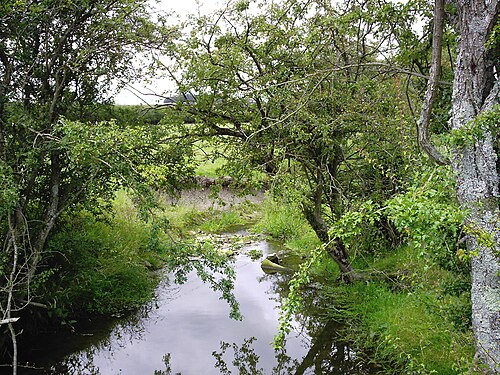
منبع النهر أو الجدول هو النقطة الجغرافية التي يبدأ منها، وتحديدًا حيث تبدأ مياه الجريان السطحي بالتجمع في مجرى مائي. وللنهر أو الجدول الذي يصب فيه نهر أو جدول واحد أو أكثر من الأنهار أو الجداول ، منابع متعددة، وهي جميع منابع روافده. كل منابع النهر أو الجدول هي أحد مصادر النهر أو الجدول، حيث تبدأ مياه الجريان السطحي من الأمطار أو ذوبان الثلوج أو الينابيع بالتجمع لتشكل تدفقًا أكبر وأكثر انتظامًا، ليصبح رافدًا رئيسيًا لذلك النهر أو الجدول. أما الرافد ذو أطول مجرى بين جميع روافد النهر أو الجدول، والذي يُقاس طوله من منبعه إلى مصبه في النهر أو الجدول، فهو المجرى الرئيسي للنهر أو الجدول المعني.
تعريف

تُعرّف هيئة المسح الجيولوجي الأمريكية ( USGS) طول النهر بأنه المسافة من مصبه إلى أبعد نقطة من منابعه (بغض النظر عن اسم المجرى)، أو من مصب النهر إلى منابع المجرى المعروف باسم المجرى الأصلي. فعلى سبيل المثال، تُصنّف الهيئة نهر ميسوري أحيانًا رافدًا لنهر المسيسيبي . إلا أنها تتبع التعريف الأول (كما تفعل معظم الهيئات والمنشورات الجغرافية الأخرى) في استخدام الطول الإجمالي لنهر ميسوري ونهر المسيسيبي السفلي في قوائم أطوال الأنهار حول العالم. [ 1 ] ولأن معظم الأنهار لها روافد عديدة وتتغير أسماؤها باستمرار، فمن المعتاد اعتبار أطول رافد أو مجرى هو المنبع، بغض النظر عن الاسم الذي يحمله هذا المجرى المائي على الخرائط المحلية أو في الاستخدام الشائع.
This most commonly identified definition of a river source specifically uses the most distant point (along watercourses from the river mouth) in the drainage basin from which water runs year-around (perennially), or, alternatively, as the furthest point from which water could possibly flow ephemerally.[2] The latter definition includes sometimes-dry channels and removes any possible definitions that would have the river source "move around" from month to month depending on precipitation or ground water levels. This definition, from geographer Andrew Johnston of the Smithsonian Institution, is also used by the National Geographic Society when pinpointing the source of rivers such as the Amazon or Nile. A definition given by the state of Montana agrees, stating that a river source is never a confluence but is "in a location that is the farthest, along water miles, from where that river ends."[3]
Under this definition, neither a lake (excepting lakes with no inflows) nor a confluence of tributaries can be a true river source, though both often provide the starting point for the portion of a river carrying a single name. For example, National Geographic and virtually every other geographic authority and atlas define the source of the Nile River not as Lake Victoria's outlet where the name "Nile" first appears, which would reduce the Nile's length by over 900 km (560 mi) (dropping it to fourth or fifth on the list of world's rivers), but instead use the source of the largest river flowing into the lake, the Kagera River. Likewise, the source of the Amazon River has been determined this way, even though the river changes names numerous times along its course.[4] However, the source of the Thames in England is traditionally reckoned according to the named river Thames rather than its longer tributary, the Churn— although not without contention.[5]
When not listing river lengths, however, alternative definitions may be used. The Missouri River's source is named by some USGS and other federal and state agency sources, following Lewis and Clark's naming convention, as the confluence of the Madison and Jefferson rivers, rather than the source of its longest tributary (the Jefferson).[3] This contradicts the most common definition,[6] which is, according to a US Army Corps of Engineers official on a USGS site, that "[geographers] generally follow the longest tributary to identify the source of rivers and streams." In the case of the Missouri River, this would have the source be well upstream from Lewis and Clark's confluence, "following the Jefferson River to the Beaverhead River to Red Rock River, then Red Rock Creek to Hell Roaring Creek."
Characteristics

Sometimes the source of the most remote tributary may be in an area that is more marsh-like, in which the "uppermost" or most remote section of the marsh would be the true source. For example, the source of the River Tees is marshland.
The furthest stream is also often called the head stream. Headwaters are often small streams with cool waters because of shade and recently melted ice or snow. They may also be glacial headwaters, waters formed by the melting of glacialice.
Headwater areas are the upstream areas of a watershed, as opposed to the outflow or discharge of a watershed. The river source is often but not always on or quite near the edge of the watershed, or watershed divide. For example, the source of the Colorado River is at the Continental Divide separating the Atlantic Ocean and Pacific Ocean watersheds of North America.
Example
A river is considered a linear geographic feature, with only one mouth and one source. For an example, the Mississippi River and Missouri River sources are officially defined as follows:
- "Largest Rivers in the United States". United States Geological Survey.
- نظام معلومات الأسماء الجغرافية لهيئة المسح الجيولوجي الأمريكية: نهر المسيسيبي ، الطول: 2340 ميلاً (3770 كم) ، المنبع: 47°14′22″ شمالاً 95°12′29″ غرباً / 47.23944° شمالاً 95.20806° غرباً / 47.23944؛ -95.20806
- نظام معلومات الأسماء الجغرافية لهيئة المسح الجيولوجي الأمريكية: نهر ميسوري ، الطول: 2540 ميلاً (4090 كم) ، المنبع: 45°55′39″ شمالاً 111°30′29″ غرباً / 45.92750° شمالاً 111.50806° غرباً / 45.92750؛ -111.50806
الاستخدامات ذات الصلة
يمكن استخدام الفعل "ينبع" للتعبير عن المنطقة العامة لمنبع النهر، وغالبًا ما يُقيد بظرف مكان. على سبيل المثال:
- ينبع نهر التايمز من مقاطعة غلوسترشير.
- ينبع النيل الأبيض من منطقة البحيرات العظمى في وسط أفريقيا.
تشير كلمة "مصدر" عند تطبيقها على البحيرات بدلاً من الأنهار أو الجداول، إلى تدفق المياه إلى البحيرة . [ 7 ] [ 8 ]
انظر أيضاً
مراجع
- ↑ "صحيفة حقائق المياه | أكبر الأنهار في الولايات المتحدة" (ملف PDF) . هيئة المسح الجيولوجي الأمريكية . 1992. تم الاطلاع عليه بتاريخ 12 أكتوبر 2024 .
- ↑ سميث، دونالد (21 ديسمبر 2000). "مستكشفون يحددون منبع الأمازون" . أخبار ناشيونال جيوغرافيك . مؤرشف من الأصل في 13 أبريل 2001.
- 1 2 نيل، دونالد ف.؛ ديتريادس، أنتوني. "أقصى امتدادات نهر ميسوري الحقيقية" (ملف PDF) . مونتانا آوتدورز ( عدد يوليو-أغسطس 2005). إدارة الأسماك والحياة البرية والمتنزهات في مونتانا : 10-13 . تاريخ الاسترجاع: 12 أكتوبر 2024 .
- ↑ « المعهد البرازيلي للجغرافيا والإحصاء ينضم إلى مجموعة تبحث عن المنبع الحقيقي لنهر الأمازون» (بيان صحفي). المعهد البرازيلي للجغرافيا والإحصاء . 22 مايو/أيار 2007. مؤرشف من الأصل في 15 يونيو/حزيران 2011.
- ↑ بيلي، ديفيد (15 مايو 2012). "هل يمكن أن يكون نهر التايمز أطول من نهر سيفرن؟" . بي بي سي نيوز . تم الاطلاع عليه بتاريخ 12 أكتوبر 2024 .
- ↑"Rediscovering Missouri River Connections | Program"(PDF). 8th Annual Missouri Rivers Natural Resources Conference 2004. United States Geological Survey. Archived from the original(PDF) on February 13, 2015.
- ↑"Pacific Southwest, Region 9 | Air Actions, California | Owens Valley Particulate Matter Plan Q & A". United States Environmental Protection Agency. Archived from the original on June 1, 2017.
...the Owens River, the source of the lake...
- ↑Guzmán, Casallas; Enrique, Jorge (January 21, 2005). Limnological investigations in Lake San Pablo(PDF) (Thesis). Technische Universität Berlin. doi:10.14279/depositonce-1034. Archived from the original(PDF) on June 25, 2008.
...source of the lake is the River Itambi...
Bibliography
- DeBarry, Paul A. (2004). Watersheds: Processes, Assessment and Management. John Wiley & Sons.
External links
- How a Duck Broke EVERY Map on YouTube– Video by Paul Whitewick (@pwhitewick) discussing the true origin points of streams, uploaded 8 March 2026
- Water streams
- Fluvial landforms
- Freshwater ecology
- River morphology